
Laredo ZIP Code Directory Coverage
USPS ZIP codes are mail-routing constructs. They do not necessarily follow the incorporated City of Laredo boundary, and a mailing city can cover an address outside the city. The rows below use only the postal context located in the research: state geocode entries, Census ZCTA context, inspected facilities, and the USPS mail-sorting listing. They are starting points for an address check, not neighborhood maps or residency claims.
| ZIP code | Area context | Post office clue | Search note |
|---|---|---|---|
| 78040 | Central and downtown Laredo postal context | El Centro facility | Verify each street because mailing city and corporate limits can differ |
| 78041 | Broad Laredo delivery context | Laredo station on East Saunders | No official neighborhood boundary was located |
| 78042 | Postal routing context | No definitive local facility assigned in the research | Use the full USPS address lookup |
| 78043 | Laredo-area postal and contract-unit context | Laredo Pony Express contract postal unit | Check delivery geography and GIS boundaries |
| 78044 | Postal routing context | No reliable official neighborhood assignment located | Street-specific verification is required |
| 78045 | Broad northern and Del Mar facility context | Del Mar station | Confirm city or ETJ status for the exact address |
| 78046 | Laredo-area ZIP and Census ZCTA context | USPS DMM grouping with Laredo 78041 | Exact official neighborhood coverage was not located |
| 78049 | Commonly listed Laredo-area code | Current official facility or service description not located | Keep as a verification row, not a neighborhood assignment |
Texas geocode material identifies core entries 78040 through 78044, while the Laredo Census profile includes ZCTAs such as 78040, 78041, 78043, 78045, and 78046. ZCTAs are statistical approximations of service areas. They are useful for broad population context, but they are not legal city or parcel boundaries.
Laredo ZIP Codes Are Postal Geography
Postal routing, municipal limits, county limits, an extraterritorial jurisdiction, a subdivision, and a parcel are different layers. A Laredo mailing address might be in the incorporated city, in the five-mile ETJ, or in an unincorporated Webb County area. The right tool depends on the question. USPS resolves a standard mailing format and delivery ZIP. Webb County maps locate broad governmental and subdivision geography. WCAD layers help place a parcel in relation to boundaries and roads.
The USPS DMM L012 listing groups 78040 and 78043 with Laredo 78040, 78041 and 78046 with Laredo 78041, and 78042 with the 78044 to 78045 context in a mail-sorting scheme. That grouping is not a neighborhood map. It does not mean every delivery address in those codes is in the same municipality or has the same local service relationship.
Practical boundary check. Use USPS for delivery formatting, then use Webb County GIS maps for city limits, the five-mile ETJ, roads, districts, and subdivision geography.
Note: A ZIP result confirms a mailing result, not an occupant, municipal status, or parcel ownership finding.
Laredo ZIP Code Searches Start With USPS
Use the USPS ZIP Lookup before searching records by a ZIP filter. Its By Address mode uses a required street address, city, and state, with company and apartment or suite details optional. Units matter when a street has multiple matches. By City and State can return ZIP information for a place, and Cities by ZIP works in the other direction. USPS warns that its result does not confirm that a person or company is at the address.
| USPS search mode | Required input | Helpful optional detail | Use in a ZIP search |
|---|---|---|---|
| By Address | Street address, city, state | Company, apartment, suite, other unit, ZIP | Normalize one delivery address before a records search |
| By City and State | City and state | None listed in the captured inventory | Find postal options for the place name |
| Cities by ZIP | ZIP | None listed in the captured inventory | Check the city association for a postal code |
After USPS normalizes the address, move to the record type. The Webb tax portal accepts account number, billing number, owner name, and situs address. Its public instructions say name searches use last name then first name and address searches use a street or PO number plus street name. A ZIP alone is not one of the captured tax-search fields.
- Enter the complete address and unit in USPS By Address. Save the returned address format and ZIP as a date-stamped research note.
- Check the location against the county map or WCAD boundary layer. Record whether the address appears in the city, ETJ, or another Webb County geography.
- Use the normalized street form in the tax portal or another official index that accepts the appropriate identifier. Keep owner, mailing, and situs fields separate.
- For registration questions, contact the county voter registrar or use the official state route. Do not use a ZIP result as proof that a person is currently at the address.
Webb Elections is the local registrar, located at 1110 Washington Street, Suite 103. Its office covers 69 precincts, three school districts, six cities, and Laredo College. The official state lookup guidance says registration information can be sought by name, county, date of birth, and ZIP, but the live public route was access-blocked during research. Form 21-56 and Form 24-1 are the located voter-list and data-request routes, although the current fields, fee, affidavit language, and delivery format should be checked with the registrar before a request.
Laredo ZIP Code Facilities Offer Clues
Facility addresses help explain the postal context without defining the full area served. The research located El Centro at 1300 Matamoros Street for 78040, the Laredo station at 2700 East Saunders Street for 78041, Del Mar at 2395 East Del Mar Boulevard for 78045, and the Laredo Pony Express contract postal unit at 3911 Jaime Zapata Memorial Highway for 78043. The facility ZIP is an operational clue, not a service-boundary map.
The Census QuickFacts profile for Laredo provides the corresponding population and geography context used for the captured ZIP and ZCTA reference image.
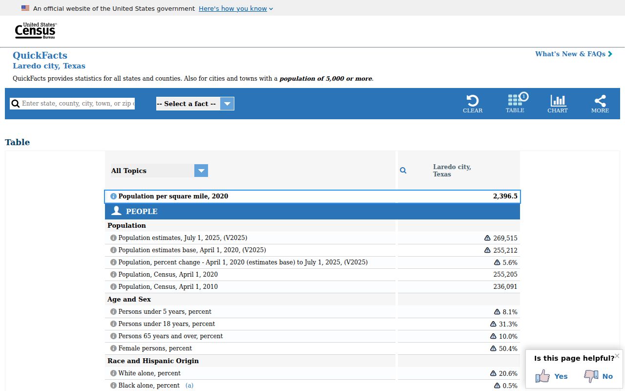
Census geography is valuable for a broad map overlay, but it cannot select a street-level delivery address or declare a parcel's legal city status. Pair it with USPS and Webb County's current boundary material.
Laredo ZIP Code Boundaries and City Limits
The key Laredo ZIP code mismatch is simple: a postal city is not an incorporated-city finding. A street may receive a Laredo mailing address while lying outside the City of Laredo boundary, and a ZIP can span broad delivery geography. For a record request, that difference can change which office holds the file. It also affects whether a map, permit, or local registrar is the correct starting point.
The WCAD ArcGIS map service is updated daily and includes parcels, roads, city boundaries, county boundaries, subdivision boundaries, and taxing-district layers. The County's downloadable maps add corporate limits, ETJ, precinct, road, and unincorporated-subdivision views. Map materials carry a general-reference warning, so use them to orient the search and verify disputed boundaries with the appropriate office.
For an address in an unincorporated subdivision, a map sheet name is a geographic clue rather than a city-status answer. Webb County's map inventory includes sheets for places such as Bonanza Hills, Botines, Four Points and Sunset, La Coma, Laredo Ranchettes, Las Haciendas, Los Altos, Ranchitos variants, San Carlos, and Village East. Confirm the street on the current sheet, then compare the same location with the corporate-limit or ETJ layer. The WCAD service can supply parcel, cadastral, abstract, page-index, and road context, but the captured research did not establish a final identify-popup field list.
Once the ZIP step identifies a street, use the Laredo by-street directory for the address-keyed record trail. It is the appropriate next step for a parcel, deed, or current boundary question.
Laredo Postal Search Terms
Postal terms describe delivery systems, while land-record terms describe geography or ownership. Keeping the vocabulary separate helps prevent a postal-directory search from making a broader claim than the source supports.
- ZIP code
- A Postal Service routing code used to direct mail. It is not a legal city boundary or a list of residents.
- ZIP+4
- An added four-digit segment that can narrow delivery sorting beyond the five-digit ZIP. It should be checked with the full address.
- PO box ZIP
- A code used for post-office-box delivery. It does not identify a street address for the box holder.
- Carrier route
- A mail-delivery grouping used for routing. It is not a neighborhood boundary or a residency finding.
- Census ZCTA
- A statistical approximation of ZIP service geography used for Census data, not a USPS delivery or legal municipal boundary.
These distinctions also protect a search from false precision. A tax account can be keyed by situs address, a voter record can have confidentiality controls, and a ZIP can be only the first step in organizing a lawful, date-specific search.
Laredo ZIP Code Searches Need a Record Key
A ZIP can organize an address search, but the public records described for Webb County use other identifiers. The tax portal uses account number, billing number, owner name, or situs address. A recorded instrument is tied to its date, parties, instrument number, and legal description. WCAD maps use parcel and boundary layers. A voter lookup can use name, county, date of birth, and ZIP, but its available fields and confidentiality controls differ from property records.
That is why a search should keep each key with the source that issued it. A normalized ZIP and street form can help find the situs record. The account number, parcel ID, or legal description can then lead to the appropriate tax, mapping, or County Clerk material. An owner or tax mailing entry does not establish current occupancy. Record both the exact query and the date because portal layouts, map layers, and delivery results can change.
Laredo ZIP Code 78049 Needs Verification
ZIP 78049 appeared in common Laredo-area listings, but the research did not locate a definitive current USPS service description or distinctive facility assignment. It should remain a verification item. Do not label it as a neighborhood, a unique ZIP, or an indicator that an address is inside Laredo without checking the full address in USPS and the location in Webb County mapping.
This is the useful myth check for ZIP research: a familiar code can be a legitimate lead and still lack enough official detail for a location conclusion. Record the date of the USPS result, the returned city label, and the applicable city or ETJ map layer before using it to route a records question.
Note: When a ZIP search and a boundary map differ, preserve both results and ask the record custodian which geography controls that record class.