
Laredo Previous Resident Sources
The best source for past residents depends on the era and on the question. A deed is a recorded transaction, not an occupancy list. A directory or census can provide household context for its own date, but may omit people or reflect publication lag. Sanborn maps establish built-environment context, not a person’s presence. For a Laredo address, build the trail in layers and preserve the date and custodian for every layer. The County Clerk, Laredo historical repositories, federal census material, the City permit route, and map collections each contribute a different piece.
| Source | Years it covers | Where held | What it shows |
|---|---|---|---|
| Webb County Clerk official records system | 1982-present computer-system statement; older originals and scanning extend into the 1800s through 1991 | County Clerk and official CountyFusion/GovOS route | Recorded instruments, including deeds, liens, releases, plats, and legal descriptions |
| Laredo directories | Located issues include 1900, 1911, 1920-21, 1922-23, 1923-24, 1930, 1935, and selected 1964-1985 years | Laredo Public Library, Texas State Library, and heritage sources | Dated name, address, business, or household context when printed |
| Library of Congress Sanborn maps | 1885, 1889, 1894, 1900, 1905, and 1909 | Library of Congress map collection | Street index, lots, building footprints, material, stories, and labeled uses |
| Federal census | 1950 is open at the 2026 research date; later releases follow the 72-year rule | National Archives and research repositories | Dated household and enumeration-geography snapshot |
| City permit and occupancy records | Historical cutoff not located | City Building Development Services or the Laredo Open Records Center | Permit, certificate-of-occupancy, zoning, or development context by address |
Begin with the source nearest the time period, then test it against a different record type. The official online index does not currently supply a published completeness statement for every historical instrument series, so an online result or no-result is not the end of the search.
Laredo Previous Residents Need Four Keys
Before looking for who lived here before, keep four identifiers apart: the recorded-instrument number, the appraisal or tax account and PIDN, the legal description, and the street address. In Laredo, one can lead to another, but they are not the same thing. A deed may name parties and a legal description. A tax record presents appraisal or tax information. A GIS parcel represents geography. A street address can change, be abbreviated, or apply to more than one unit.
The Webb County tax portal is a practical starting point when a current situs address is known. The County’s official instructions document account number, billing number, name, and situs address searches. An address search uses Street/PO Number and Street Name; results include Account Number and Owner Name, and the account link opens more property information. A mailing-address search may help when a property is hard to find. The displayed owner or mailing information is not an occupant field.
For spatial context, the WCAD GIS service updates daily and includes parcels, cadastral lines, subdivisions, abstracts, taxing districts, city boundaries, roads, and other layers. Exact live identify-popup fields were not captured. Use its map layers to check a parcel’s setting, then keep the legal description and the entered address with the research record.
Trace Webb County Deed Chains
For prior ownership, the Webb County Clerk is the custodian for deeds, property records, liens, releases, plats, assumed names, and related instruments. The Clerk’s official public-records link redirected to a login path and did not expose usable search fields during research. The records-management statement says the computer system holds Official Public Records information from 1982 to the present, while older books from the early 1800s through 1991 are being scanned and verified. That is a system statement, not a promise that every image or index is complete.
- Use the tax account or GIS parcel to record the current address, legal description, and available account identifier.
- Check the County Clerk’s official route for a matching recorded instrument, preserving its date, instrument number, parties, and legal description.
- Read the current purchase record for the seller, then search that seller as a grantee in an earlier acquisition when the index permits.
- Repeat the dated transaction trail backward, comparing legal descriptions rather than assuming an old street address is unchanged.
- When the official online route is incomplete, ask the Clerk about older books, scanned material, an image, or a certified copy.
- Grantor
- The party conveying an interest in a recorded instrument.
- Grantee
- The party receiving that interest in the recorded instrument.
- Chain of title
- The dated sequence of recorded transfers used to follow ownership interests backward.
- Legal description
- The parcel description in the instrument, often more reliable than a changing street address for older research.
For direct help, the County Clerk is at 1110 Victoria Street, Suite 201, Laredo, TX 78040, 956-523-4266. The property-record landing page was under construction during research, so confirm current search access and copy procedures with the Clerk.
Laredo Previous Residents on Maps
Sanborn fire-insurance maps are the strongest historic bridge between a Laredo address and the block’s physical form. The Library of Congress July 1900 Laredo record has 10 sheets. Related editions were located for 1885, 1889, 1894, 1905, and 1909. Their street indexes, lot outlines, building footprints, construction material, number of stories, and labeled public or commercial structures can test whether a location existed or how the block changed. They do not establish that a particular person owned or occupied the building.
| July 1885 | 3 sheets, the earliest listed snapshot in this set. |
|---|---|
| July 1889 | 3 sheets for comparing central blocks and structures. |
| February 1894 | 9 sheets with a broader mapped area. |
| July 1900 | 10 sheets in the inspected Library of Congress record. |
| December 1905 and November 1909 | 11 and 12 sheets, respectively, for later pre-1910 changes. |
Pair a mapped block with a directory year and a recorded instrument only after checking the date of each item. A 1900 directory listing and a 1900 building label are contemporaneous clues, not a full occupancy record. That distinction gives a Laredo address history more value than a single unsupported match.
Laredo Previous Resident Archive Trail
Libraries and archives can fill the household layer that a deed chain cannot. The Laredo Public Library’s Luciano Guajardo Historical Collection includes telephone and city directories, yearbooks, microfilm, newspapers, clippings, maps, photographs, and family trees. It accepts mail, fax, and email requests under its policy, but its closed-stack room has sign-in, handling, no-checkout, and reproduction-permission rules. Staff offer local-history help without undertaking original genealogical research for a requester.
The Portal to Texas History’s Laredo Public Library partner collection is shown below because its digitized photographs, maps, border material, and Fort McIntosh content can help identify a place or institution that appears in an address history.
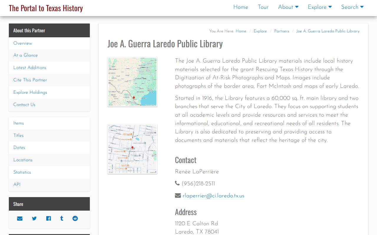
The collection is a selected digitized resource, not a complete list of previous residents. A caption may help date a street, landmark, or institution. It must be read with the item record and then compared with a directory, map, or deed for the separate fact each source supports.
Pair Laredo Past Residents with Census
Owners are only one layer of a household trail. A historic directory may supply a name or address for its publication year. A census can show a household snapshot for its enumeration year. Newspaper, yearbook, and family-collection material can provide a separate event or institutional clue. The city-directory collections themselves are described in the Laredo city directory collections, while this address-focused trail keeps the sources in date order.
- Start with the known address form and record any older spelling, abbreviation, unit, subdivision, block, or lot description.
- Place each located directory entry on a dated line, without inventing an annual sequence where issues are missing.
- Use the nearest available census year as a separate household snapshot and record its enumeration geography.
- Test address changes against a Sanborn sheet, deed legal description, or GIS parcel rather than treating the street string as fixed.
- Use a newspaper or archive finding aid to document a dated event, then label it as that type of evidence.
The National Archives rule provides a clear time boundary: 1950 census material was open at the 2026 research date, and 1960 is expected under the 72-year rule in 2032. Earlier Laredo census references should retain their year, enumeration geography, and source image.
Laredo Previous Resident Access Routes
When an online screen does not answer the historical question, follow the custodian chain instead of treating the gap as a no-record result. County Clerk records may need a request for older material, a scanned image, or a certified copy. The clerk’s records-management page describes paper and book records before 1991, continuing scanning, re-indexing, and verification, and official-system information from 1982 forward. For a city-created permit or certificate-of-occupancy record, identify the department, record type, date range, location, and known permit or address number in a written request through the Laredo Open Records Center route.
Historical collection requests follow different rules. The library policy accepts mail, fax, and email requests; a reading-room visit may be better for material that needs title-page, map-key, or neighboring-page review. TAMIU SPARC is another reading-room route for regional collections, maps, newspapers, and family material. Ask for a collection title, box or folder, finding-aid reference, surname, event, institution, or street. A family collection may also have access or reproduction limits.
Note: An address request is most useful when it identifies the source type and date range, rather than asking one custodian to infer an entire household history.
Use Laredo Address History Carefully
Laredo previous residents research is best used for family history, house history, an estate question, or personal curiosity about a place. A name in a directory, tax result, map, court file, or public meeting record has a limited meaning. It may identify a publication-year listing, transaction party, map label, or named appearance. It does not prove continuous residence, current presence, ownership, or a relationship that the record does not state.
Lawful personal use. Keep historic address research focused on the dated record trail, and never use information found in Laredo sources to harass, stalk, or harm anyone.
Do not publish unnecessary personal details from a family tree, reading-room item, or old address list. The Texas Secretary of State and County Clerk also describe confidentiality and redaction limits for certain public records. For a current address-keyed records path, use the Laredo by-street directory rather than stretching old material into a present-day claim.
Check Laredo Previous Resident Evidence
End each address trail by checking whether the sources agree on the date, parcel, and physical place. A modern PIDN or tax account should not be assumed to survive a replat, split, or annexation. If GIS and a deed description diverge, request the County Clerk’s instrument image and note the conflict. A Sanborn sheet can explain a historical footprint but not an ownership change. A map, directory, and deed strengthen one another when their dates and limits are visible.
That record-by-record method also respects the known research gaps. The official CountyFusion/GovOS interface did not expose a live field inventory, a complete parcel-by-parcel deed chain was not available, and the current WCAD identify-popup field list was not captured. Verify the live system before relying on its current field layout or cutoff. Careful uncertainty is more useful than filling a missing link with a guess.