
Search Laredo Streets by Address
A Laredo street directory search works best as a short record trail, not as a claim that one source names every person at an address. Start with the address as written, then try the format used by the tax source or a historic record. The Webb tax search can connect a situs address, meaning the property’s physical location, to an account and owner name. WCAD mapping then places that parcel among roads, subdivisions, and public boundaries. A deed or other recorded instrument can add a transaction date and legal description. Historic directories and maps may add a dated household or building clue. Each result has a different meaning and date.
- Normalize the address with USPS ZIP Lookup, including any unit or suffix. USPS standardizes delivery information; it does not confirm that a person is present there.
- Search the Webb County tax portal by street or PO number and street name. Record the account number, owner name, and the date retrieved.
- Use the WCAD ArcGIS service to orient the address within a parcel, road, subdivision, and city or district boundary layer.
- For a dated transfer or legal description, check the County Clerk’s official public-records route, then ask the clerk for an image or certified copy when the online system does not expose it.
- For an older household clue, compare a directory year and a Sanborn sheet rather than treating either as proof of present occupancy. Historical collections are a separate strength of the Laredo city directories.
This order keeps the identifiers straight. An account or PIDN is not a deed number, and a legal description is not always a postal address. Note: Save the exact address form and retrieval date because an abbreviation, unit, or boundary layer can change a Laredo result.
Laredo Street Directory Search Fields
The Tax Assessor-Collector provides the clearest current address route in the Laredo street directory. Its published instructions identify four modes: account number, billing number, name, and situs address. For a situs query, use Street/PO Number plus Street Name. A name query separates last and first name. Results include an account number and owner name, and the account number opens more property detail. When a situs search fails, the instructions suggest a mailing-address search. That last option may locate an account, but a tax mailing address is not evidence that the owner lives at the parcel.
| Webb tax field | Entry format | What the result can support |
|---|---|---|
| Account Number | Account identifier | Direct access to a known tax account |
| Billing Number | Billing identifier | Tax billing record discovery |
| Owner Name | Last name, then first name | Possible owner-account match |
| Situs Address | Street/PO number and street name | Property account associated with the physical address |
| View Details | Open an account result | Additional property information and print options |
The captured tax instructions are available at the Webb tax-search entry point.
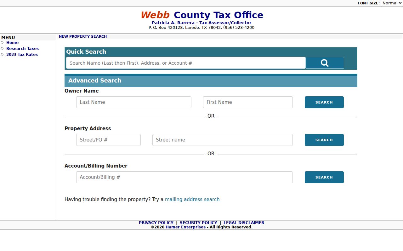
Use the image as an entry-point reference, then recheck the live form before relying on labels or result fields. The research inspection did not capture a live current account card, so it is safer to preserve the portal’s own terms than to infer extra fields.
Laredo Parcel Layers by Street
A tax result becomes more useful when paired with the WCAD map service. The service is updated daily and lists parcels, subdivision boundaries, cadastral lines, abstracts, page index, city boundaries, roads, county boundary, and several taxing or special-district layers. In a Laredo street directory search, these layers answer the geographic part of the question: which parcel is at the address, which roads meet it, and whether the map places it inside a city boundary, a five-mile ETJ, or a county subdivision. The research did not capture the final identify-popup field list, so verify individual attributes at the current source.
WCAD’s official ArcGIS map service is the daily-updated parcel and boundary source recorded in the manifest.
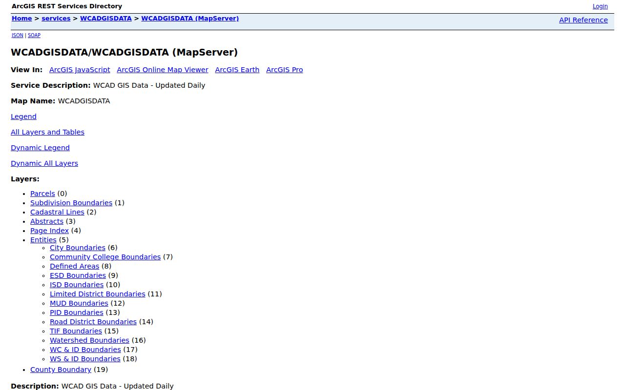
Its layers give spatial context, not a final ownership conclusion. Confirm the account and any instrument through the matching tax or clerk record.
The County also links an interactive GIS entry point, shown in the captured source below. Its live interface was not fully available during research, so use it as a current access route and confirm what a particular map tool displays before recording it.
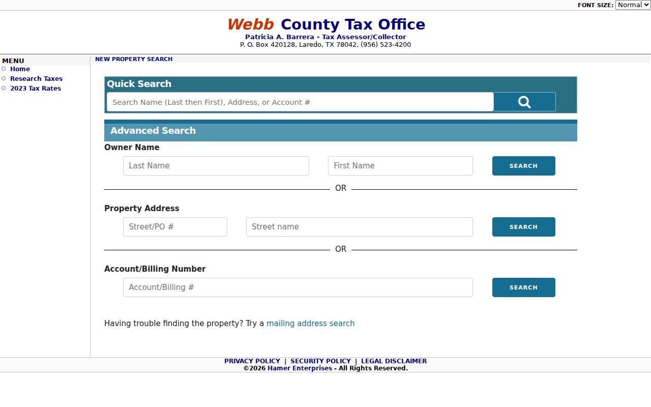
For broader context, Webb County GIS Maps offers city-limit, ETJ, road, district, flood-study, and subdivision map families, each subject to the County’s general-reference disclaimer.
Laredo Records Searchable by Street
No one record set answers every by-address question. The tax portal is strongest for a current account trail, GIS is strongest for parcel placement, and the County Clerk is the custodian for recorded instruments. City permit and certificate-of-occupancy records can describe work or a documented building process, not necessarily a household. Webb Elections is the registrar route for voter-registration questions, but its information has confidentiality limits. Older directories and Sanborn maps are dated evidence. Keeping those roles separate makes a Laredo street directory result more accurate.
| Address-keyed source | Custodian or route | Useful record detail | Access boundary |
|---|---|---|---|
| Tax account | Webb Tax Assessor-Collector | Situs search, account number, owner name, details | Current interface should be checked |
| Parcel map | WCAD ArcGIS | Parcel, road, subdivision, abstract, district, boundary layers | Daily reference service; popup fields were not captured |
| Recorded instrument | Webb County Clerk | Deed, lien, release, plat, parties, date, legal description | Online fields and complete cutoff remain a gap |
| City development record | Building Development Services | Permit, certificate-of-occupancy, zoning, or right-of-way context | Confirm current portal fields and public availability |
| Registration information | Webb Elections and state routes | Registration jurisdiction or available address information | Protected fields and request rules apply |
| Historic street source | Laredo Public Library, TAMIU SPARC, LOC, and directories | Publication-year name, address, sheet, lot, or building use | Historical snapshot only |
The field that ties several records together may be an address, a parcel identifier, or a legal description. It should be copied exactly and compared against its record date before it is used as a lead in another source.
Laredo Street Directory Deed Trail
Recorded instruments supply the transaction layer behind a street address. The Webb County Clerk is responsible for deeds, property records, liens, releases, plats, and related records. County records management says its computer system holds Official Public Records information from 1982 to the present; older original books and scanning work extend into the 1800s. That statement describes the system and preservation work, not a guarantee that every historical image or index entry is available online. A result should be verified with the Clerk, especially when a legal description or instrument number is the only match.
The County Clerk identifies CountyFusion/GovOS as its official public-records login.
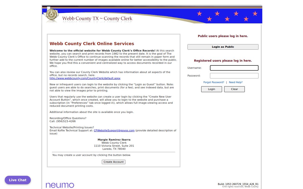
The research session reached a redirected login and did not expose search fields or sample images. For a missing image or uncertain index result, contact the Webb County Clerk at 1110 Victoria Street, Suite 201, Laredo, or use its current request instructions. The records-management page is also the source for the ongoing scanning and verification caveat.
Note: A grantor is the party transferring an interest and a grantee is the party receiving it, but either name describes a recorded transaction rather than a present household.
Laredo Street Directory Boundaries
Street searches can fail when postal geography is mistaken for municipal geography. USPS provides the standard address and ZIP route, while Webb GIS supplies corporate-limit, ETJ, county-boundary, road, and subdivision context. A Laredo mailing city may sit outside the incorporated City, within the five-mile extraterritorial jurisdiction, or in another Webb County community. The jurisdiction can change which office created the requested city record, even though the postal city reads Laredo.
USPS offers By Address, By City and State, and Cities by ZIP searches. The address form requires a street address, city, and state, with optional company, unit, and ZIP fields. USPS expressly says its result does not prove that a person or company is at an address. Start there for formatting, then use the County’s boundary source for jurisdiction. The published subdivision maps include many unincorporated areas, so a map-sheet label alone does not establish a neighborhood or city status.
Laredo Street Directory Historic Blocks
The built-environment trail is a useful interest layer when an address has a long history. The Library of Congress Laredo Sanborn record includes a July 1900 map with 10 sheets and related 1885, 1889, 1894, 1905, and 1909 editions. Their street indexes, lot outlines, building footprints, construction symbols, and labeled structures can help identify how a block looked at a specific time. They do not identify a modern household or prove who owned a building.
Pair one map year with a city-directory year, then compare it with a recorded instrument or modern parcel. The dated sequence is the point: a directory records a published name-address clue, a Sanborn sheet records a building context, and a deed records a transaction. Laredo’s official history places the city’s early settlement near present San Agustín Plaza, giving older central-block research a civic setting without turning it into a private-person profile.
For old names and publication-year addresses, use the historical collections rather than applying a modern tax record backward in time. Note: A historical block match becomes stronger when two independent sources agree on the date, street form, and building context.
Laredo Street Directory Terms
Street records use several terms that should not be collapsed into one another. A parcel is the mapped unit of land used in appraisal and mapping systems. A situs address is the physical address associated with that property. A plat is a recorded map that can show lots, blocks, easements, and subdivision layout. A criss-cross directory is a reverse-style directory organized by address, useful for a publication-year household clue. These terms make it easier to follow the right record trail without assuming that a map, tax account, and directory list mean the same thing.
- Parcel
- A spatial land unit shown on a map or appraisal record.
- Situs address
- The property’s physical location used for an address-based tax search.
- Plat
- A recorded map used to describe lots, blocks, and subdivision layout.
- Criss-cross directory
- An address-organized historical directory, not proof of a current household.
Laredo Street Records at the Clerk
An online gap is a reason to use the custodian, not a reason to guess. The Webb County Clerk is at 1110 Victoria Street, Suite 201, Laredo, and lists 956-523-4266 for the office. Its property-record landing page was under construction during research, while its public-record link routed to the official CountyFusion/GovOS login. Bring the address, any account number, the instrument number if known, and the legal description when available. That narrow set of identifiers gives staff a defined record question and avoids asking for a broad collection of personal information.
The County Clerk records-management page explains that pre-1991 records remain in original paper and books while scanning, re-indexing, and verification continue. For an older street or plat question, the counter and the Clerk’s current request route remain the documented fallback when a portal does not return an image. Ask whether the item is indexed, scanned, or still in its original volume before relying on an apparent gap in the online search.
Laredo Street Directory Privacy Limits
A street record can show a defined public relationship, but it cannot safely stand in for a roster of every person connected to an address. A tax owner, deed party, voter registrant, permit applicant, historic directory entry, and current occupant are different categories. Texas confidentiality rules may suppress voter information, and the Secretary of State describes protected-address procedures for eligible people. The County Clerk also carries a current redaction notice for certain eligible property-record requests. Do not seek driver-license data, protected identifiers, utility-customer details, or private delivery information through a street search.
Lawful use. Laredo street records support personal, lawful research and civic curiosity. Do not use an address, parcel, or record trail to stalk, harass, threaten, or expose a protected person.
When a record appears incomplete or wrong, contact the custodian rather than filling the gap with an assumption. The Texas Public Information Act supports requests for existing records, subject to exceptions and redactions; it does not require an agency to assemble a broad personal dossier.